


Stormy weekend ahead for dozens of US states
Story by: @ FreightWaves.com
Disruptive winter weather will hit dozens of states today through this weekend and possibly beyond. Snow, ice and wind will blast through the Midwest this weekend, with more periods of heavy snowfall in the mountains of the Northwest. In the South, the threat is for strong thunderstorms and possible tornadoes.
Midwest
A major winter storm will impact parts of the Midwest and Great Lakes region this weekend. Precipitation will start as rain on Friday, changing to freezing rain and then snow on Friday night and Saturday as colder air moves into the intensifying system. The main impacts of ice, snow, wind and reduced visibility will occur Saturday through early Sunday. The storm will initially impact portions of the western Midwest – Missouri, eastern Kansas and southeastern Iowa – before it moves toward the Great Lakes – Wisconsin, northern Illinois and northern Michigan – later on Saturday. The storm will be done by Sunday morning in the Midwest and by Sunday evening in Michigan and adjacent areas of Canada.

Shippers, carriers and drivers should expect the most significant impacts in portions of Wisconsin, lower Michigan and adjacent areas of southern Canada, where 6 to 12 inches of snowfall will accumulate. As the storm cranks up, winds will become strong and gusty. This could result in areas of whiteout conditions as well as potential scattered power outages and roadblocks due to downed trees and utility lines. Blowing/drifting snow and reduced visibility could occur on and off for 24 to 36 hours.
Ice accumulations will be most significant in a swath from east-central Kansas through north-central Missouri, possibly extending close to the Chicago metro area and into central and southern portions of Michigan.
As for the major freight and transportation hub of Chicago, forecast models currently show the Windy City on the borderline of ice and heavy snow to the north and west of the city, with a mix in the downtown area and rain south and east of the metro area. As of this morning, it looks like downtown Chicago will not see the worst of this storm. However, a slight change in the track of the storm would change the impact zone shown on the FreightWaves Critical Events map above. This means the effects of the storm in Chicago and other parts of the impact zone could change. Look for updates on the FreightWaves website and social media sites.
Major interstates in the path of this storm include I-35, I-72, I-88, I-80, I-74, I-39, I-90, I-94, and I-75, affecting the cities of Kansas City, Milwaukee, Madison, Green Bay, the northern and western portions of the Chicago metro area, Quebec City, Montreal, and Ottawa.
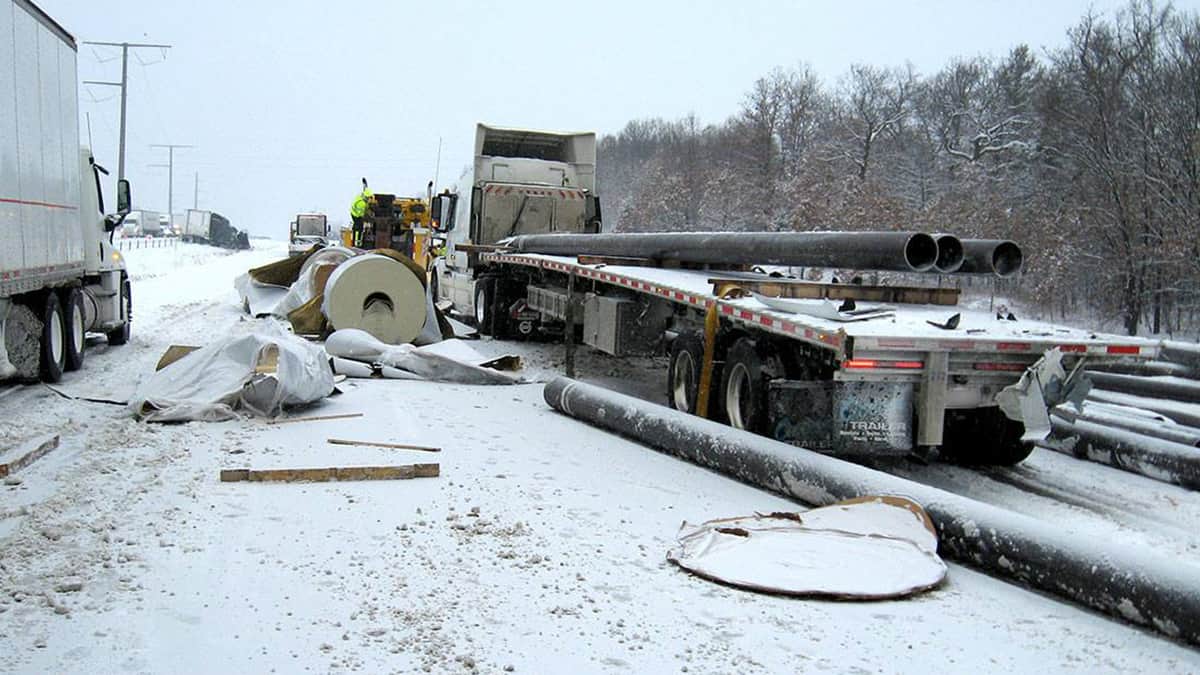
This is mainly an awareness and preparation situation. The impact on freight movement on a national level will likely be minimal. However, the storms will likely have a moderate/major effect on supply chains and business operations at the local and regional levels. Shippers and carriers should expect disruptions on roads, rails, runways and intermodal ramps during the course of the storm and possibly the day after it’s gone. These assets at risk are color-coded in Critical Events based on the anticipated level of disruption.
Northwest
Look for more mountain snowfall today and tonight scattered across the Cascades, Rockies and the Sierra Nevada. It will be heavy in some areas, with gusty winds producing occasional whiteout conditions. Drivers who cannot reroute should be extra careful on I-90 from western Montana to northern Idaho, as well as through the Cascades of Washington before reaching Seattle. The highway may still be quite slick from recent snowfalls, including over Lookout and Snoqualmie passes. The next car in this train of storms will have a bigger impact from tomorrow through at least this weekend.

Weekend snowfall totals of 12 to 24 inches are possible in the high elevations of the Washington and Oregon Cascades, in addition to the Rockies of northern Idaho and western Montana, mostly from Friday through Saturday afternoon. Another storm could arrive on Sunday. Winds will be howling and blowing snow around at times, reducing visibility.
Additional periods of snowy and windy weather are likely in these areas next week. Carriers may have to routinely reroute drivers who are trying to reach the Northwest from the Midwest southward. Weather shouldn’t be a major problem on I-80 in Nebraska prior to early Friday or on most of I-80 from Wyoming over to Salt Lake City. From there, drivers can catch I-84 to the Pacific Northwest, where snowfall should be light at the interstate level along the Washington-Oregon border.
Read the full story, watch the video, and more forecasts HERE @ freightwaves.com
Heavy snowfall continues across #LookoutPass this morning and a Winter Storm Warning is in effect through noon for the Lower Clark Fork region. #mtwx https://t.co/SxyyKaTljc
— NWS Missoula (@NWSMissoula) January 7, 2020
Source and credits: freightwaves.com /Nick Austin / iTrucker / Mario Pawlowski

2geographic
cashman casino slots free https://2-free-slots.com/
operation slots https://freeonlneslotmachine.com/
free vegas slots online https://candylandslotmachine.com/
slots free single https://pennyslotmachines.org/
heart of vegas free slots https://slotmachinesworld.com/
free netbet slots https://411slotmachine.com/
slots of montana https://slotmachinegameinfo.com/
uga dissertation https://buydissertationhelp.com/
best dissertation writing https://dissertationwriting-service.com/
dissertation literature review example https://mydissertationwritinghelp.com/
dissertation help nz https://dissertations-writing.org/
dissertation proofreading help https://helpon-doctoral-dissertations.net/